

The data catalogue is available from the FTP server ftp://ftp.merrbys.co.uk.
The MERRByS data contains some graphical outputs that can be visualised in Google Earth. The reflection power is displayed along the track by changing colour. Two separate colour maps are used: for ocean and for land.
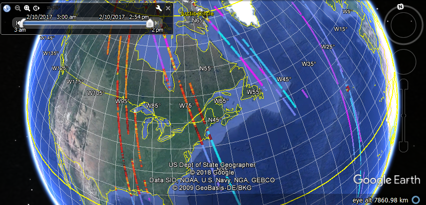
These are in the FTP server. An example for a 6 hour section of data from 2017 is at,
ftp://ftp.merrbys.co.uk/Data/L1B_Catalogue/2017-02/10/H06/2017-02.10.H06.kmz (Login needed – see Data Access)
All data is segmented in 6 hour sections then stored into folders with naming format: Year-Month/Day Of Month/’H’ hour of day [00, 06, 12, 18]. The collections are 3 hours either-side of the time in the file name.
Additionally each track has a Summary Image. This is a selection of up-to 30 DDMs that are spaced evenly through the track.
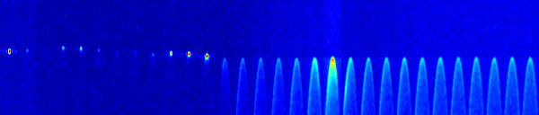
ftp://ftp.merrbys.co.uk/Data/L1B_Catalogue/2017-02/10/H06/SummaryImages.zip (Login needed – see Data Access)
Going into the data in more detail, there are example Matlab and Python scripts for previewing and searching the data that are shown in the Documentation page.
TDS-1 has been operated in a number of different modes. These are detailed in the TDS-1 Operations Timeline