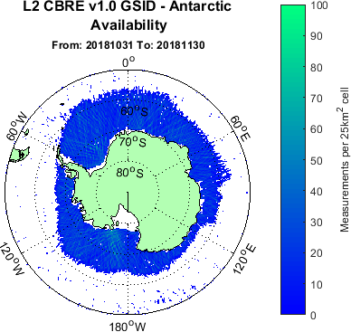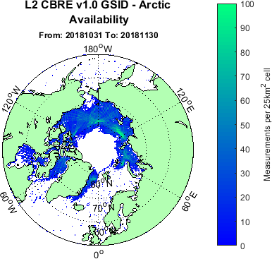

The first sea ice product on MERRByS from the TDS-1 satellite GNSS-R data catalogue has been released, and is now available on the FTP server. Surrey Satellite Technology Limited (SSTL) and the National Oceanography Centre (NOC) recently released v1.0 of the Calibrated Bistatic Radar Equation (C-BRE) processor, which provides a number of new and improved features including a novel GNSS-R Sea Ice Detection Algorithm (GSID). The output from this algorithm has been formatted into a Sea Ice product, and can be found here under “L2_CBRE_v1_0_GSID”. An updated product manual can be found here on the documentation page. We would be keen to hear feedback from users about this new capability.
A month by month availability web page has been set up to allow users to quickly view the historical ice data and can be found here.