An online introductory workshop about the ESA Scout HydroGNSS mission was held on Thursday 24th and Friday 25th of February 2022. Here is a web-link for the event including a link the agenda and recordings of sessions:
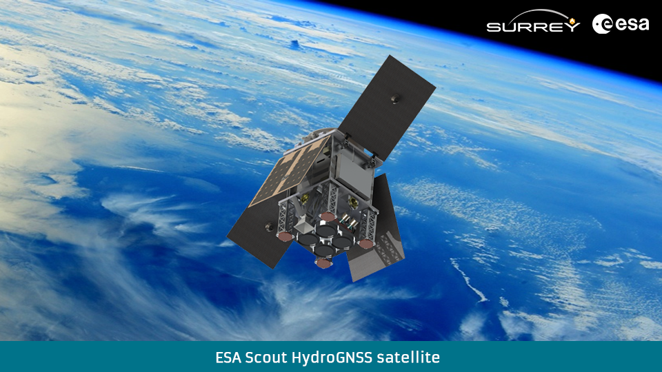
SSTL entered a contract with ESA on 11th October 2021 to provide under the new Scout small scientific satellite programme a mission called HydroGNSS to measure climate change variables using GNSS Reflectometry. SSTL is working on the project with scientific partners from Sapienza, IEEC, FMI, Tor Vergata, CNR/IFAC, NOC, Nottingham and others.
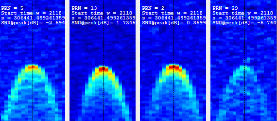
Delay Doppler Maps captured in orbit on DoT-1 during test on 13th August 2020
Surrey Satellite Technology Ltd (SSTL) has successfully demonstrated GNSS-Reflectometry (GNSS-R) from its 18kg DoT-1 satellite. SSTL has pioneered the new field of GNSS-R with successful payloads on board TechDemoSat-1 and the CYGNSS constellation, and is continuing to develop the technology and data analysis in pursuit of this new science. The latest GNSS-R payload on-board the DoT-1 satellite is incorporated within the new small form factor Core Avionics module integral to all SSTL’s future satellite platforms. This innovation paves the way for any SSTL satellite that can accommodate a nadir pointing antenna to become part of a GNSS-R small-sat constellation.
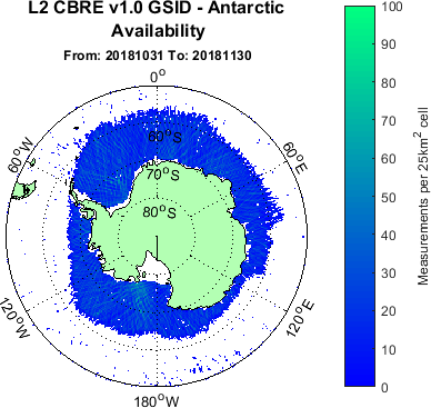
The first sea ice product on MERRByS from the TDS-1 satellite GNSS-R data catalogue has been released, and is now available on the FTP server. Surrey Satellite Technology Limited (SSTL) and the National Oceanography Centre (NOC) recently released v1.0 of the Calibrated Bistatic Radar Equation (C-BRE) processor, which provides a number of new and improved features including a novel GNSS-R Sea Ice Detection Algorithm (GSID). The output from this algorithm has been formatted into a Sea Ice product, and can be found here under “L2_CBRE_v1_0_GSID”. An updated product manual can be found here on the documentation page. We would be keen to hear feedback from users about this new capability.
A month by month availability web page has been set up to allow users to quickly view the historical ice data and can be found here.
Antarctic ice map generated using TDS-1 data between 31/10/2018 – 30/11/2019.
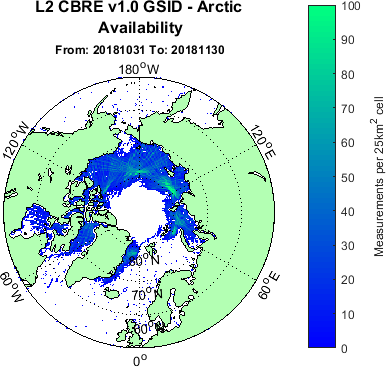
Arctic ice map generated using TDS-1 data between 31/10/2018 – 30/11/2019.
Cartographic plot showing C-BRE v0.5 and C-BRE v1.0 data availability (NOC 2019)
During an ESA-sponsored study in 2018-2019, Surrey Satellite Technology Limited (SSTL) and the National Oceanography Centre (NOC) have been collaborating to improve the L1B to L2 inversion accuracy for TDS-1 data.
The output of this work is an upgraded Calibrated Bistatic Radar Equation (C-BRE) processor (v1.0). This algorithm has been integrated into MERRByS and used to re-process the back catalogue of TDS-1 measurements.
The improvements over C-BRE v0.5 include:
Application of dual on-board / Antarctic radiometric calibration, increasing data coverage
An ice detection algorithm allowing data up to ice edges, and a new flag for presence of ice
Improved corrections for variation in GPS transmit powers
Improved flagging of processor and RFI anomalies
The data is available from the MERRByS FTP server in the data folder labelled “L2_CBRE_v1_0”. This folder can be found here.
Image of deployed drag sail taken by TDS-1 on-board inspection camera
The deployment of the Icarus-1 drag sail, which was supplied by Cranfield University, marks the end of mission operations for SSTL’s TechDemoSat-1. This sail increases the cross-sectional area of the satellite and hence atmospheric drag to speed up reentry.
SSTL posted a press release announcing the deployment. Jonathan Amos from the BBC tweeted with a special mention of the achievements of TDS-1 in GNSS Reflectometry.
Meanwhile SSTL staff members are working on an upcoming satellite mission carrying an opportunistic GNSS reflectometry experiment. We hope to bring you news about this new project very soon.